
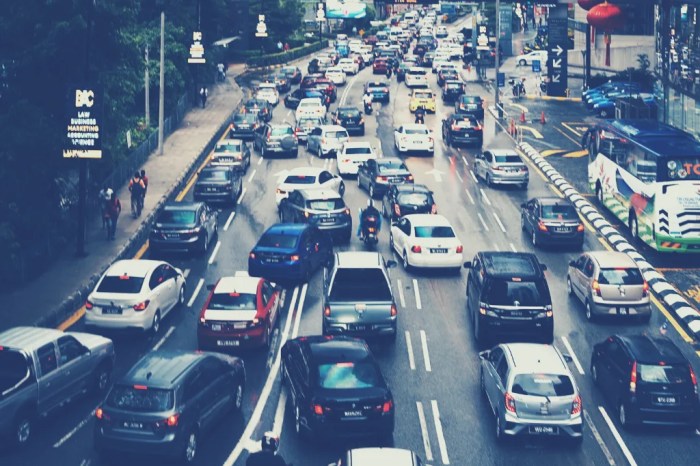
The Impact of Smart Cities on Reducing Urban Congestion isn’t just a buzzword; it’s a revolution reshaping how we navigate our increasingly crowded urban landscapes. From intelligent traffic systems predicting rush hour snarls to innovative parking solutions that banish the endless circling for a spot, smart city initiatives are tackling urban congestion head-on. This isn’t just about smoother commutes; it’s about creating more livable, efficient, and economically vibrant cities. We’ll explore how technology, urban planning, and data analysis are converging to untangle the urban traffic knot.
This exploration delves into the various strategies employed by smart cities to alleviate congestion. We’ll examine the role of intelligent transportation systems (ITS), improved public transport networks, smart parking solutions, and forward-thinking urban planning. The power of data analytics and predictive modeling in optimizing traffic flow will also be highlighted, showcasing real-world examples and innovative solutions.
Smart City Technologies and Traffic Management
Smart cities are leveraging technology to tackle the age-old problem of urban congestion. The implementation of intelligent transportation systems (ITS) is a key strategy, offering a sophisticated approach to managing traffic flow and optimizing transportation networks. These systems aim to not only reduce congestion but also improve safety, reduce emissions, and enhance the overall efficiency of urban mobility.
Intelligent Transportation Systems and Congestion Reduction
Intelligent Transportation Systems (ITS) represent a significant leap forward in traffic management. These systems use a combination of technologies, including sensors, cameras, GPS, and data analytics, to monitor traffic patterns in real-time. This allows for dynamic adjustments to traffic signals, improved public transportation scheduling, and the provision of real-time information to drivers, ultimately leading to smoother traffic flow and reduced congestion. The integration of various data sources, such as weather reports and incident reports, further enhances the predictive capabilities of ITS, enabling proactive measures to mitigate potential congestion hotspots.
Real-Time Traffic Monitoring and Data Analysis
Real-time traffic monitoring is the backbone of effective ITS. Sensors embedded in roadways, coupled with cameras strategically placed at intersections and along major thoroughfares, collect vast amounts of data on traffic volume, speed, and density. This data is then processed using sophisticated algorithms to identify congestion patterns, predict potential bottlenecks, and optimize traffic signal timings. Advanced data analytics techniques, including machine learning, are increasingly being used to refine these models and improve their accuracy, allowing for more precise and proactive traffic management. For example, the city of London uses a sophisticated system that analyzes data from various sources to predict and manage congestion during peak hours.
Adaptive Traffic Signal Control Systems
Adaptive traffic signal control systems represent a significant advancement in traffic management. Unlike traditional fixed-time traffic signals, these systems dynamically adjust signal timings based on real-time traffic conditions. This means that signals can prioritize traffic flow on congested routes, reducing delays and improving overall traffic throughput. Sensors detect traffic volume and speed, and the system uses algorithms to optimize signal timings accordingly, resulting in a smoother and more efficient flow of traffic. Cities like Los Angeles have seen notable improvements in traffic flow by implementing adaptive traffic signal control.
Comparison of ITS Technologies
Several ITS technologies contribute to congestion reduction. These include adaptive traffic signal control, advanced traveler information systems (ATIS), which provide real-time traffic updates to drivers, and intelligent transportation management systems (ITMS), which integrate various ITS components for a holistic approach to traffic management. While all aim to reduce congestion, their effectiveness varies depending on factors like city size, infrastructure, and the level of integration with other systems. For example, ATIS may be more effective in larger cities with complex road networks, while adaptive traffic signal control can be beneficial in smaller cities with simpler road layouts. ITMS offers the most comprehensive solution, integrating various technologies for a more holistic approach.
Effectiveness of ITS Technologies in Reducing Congestion
| ITS Technology | City Context | Congestion Reduction (%) | Notes |
|---|---|---|---|
| Adaptive Traffic Signal Control | Medium-sized city with moderate traffic | 15-20% | Effective in optimizing signal timings based on real-time traffic conditions. |
| Advanced Traveler Information Systems (ATIS) | Large metropolitan area with complex road network | 10-15% | Effective in providing real-time information to drivers, enabling them to make informed route choices. |
| Intelligent Transportation Management Systems (ITMS) | City with integrated ITS infrastructure | 20-25% | Holistic approach integrating various ITS components for comprehensive traffic management. |
| Public Transportation Optimization (using real-time data) | City with robust public transport network | 5-10% | Improved scheduling and routing based on real-time passenger demand and traffic conditions. |
Impact of Public Transportation on Congestion Levels
Urban congestion is a beast that chokes the life out of our cities, impacting everything from commute times to air quality. But what if we could tame this beast, not with brute force, but with a smarter, more efficient approach? Improved public transportation is a key element in that strategy, offering a viable alternative to the ubiquitous private car and potentially reshaping our urban landscapes.
Public transportation networks, when well-designed and implemented, dramatically reduce reliance on personal vehicles. By offering convenient, affordable, and efficient alternatives, they directly address the root cause of congestion: too many cars competing for limited road space. This shift towards public transit isn’t just about moving people; it’s about transforming the way cities function, creating a more sustainable and livable urban environment.
Improved Public Transportation Networks and Reduced Car Dependency
Expanding metro lines and implementing Bus Rapid Transit (BRT) systems are game-changers. Think of the Seoul Metropolitan Subway, a sprawling network that serves millions daily, significantly reducing traffic on the city’s roads. Similarly, Curitiba, Brazil’s BRT system, a model of efficiency and innovation, has drastically cut down on congestion and improved the overall quality of life for its citizens. These initiatives demonstrate that strategic investment in public transit infrastructure directly translates into fewer cars on the road and less congestion. The expansion of these systems needs to be carefully planned, considering factors such as population density, projected growth, and accessibility to different neighborhoods.
Integrated Ticketing Systems and Mobile Apps: Boosting Public Transport Usage
Imagine a world where you can seamlessly hop between buses, trains, and trams using a single, easy-to-use ticketing system. That’s the power of integrated ticketing. Paired with user-friendly mobile apps that provide real-time information on schedules, routes, and even crowding levels, these systems make public transport far more attractive. Apps like Citymapper, already popular in many cities, demonstrate the effectiveness of this approach, simplifying the public transport experience and encouraging more people to ditch their cars. The convenience factor is key; the easier it is to use public transport, the more likely people are to choose it.
Successful Public Transportation Initiatives and Congestion Reduction
The aforementioned Curitiba BRT system is a shining example. Its dedicated bus lanes, rapid transit vehicles, and integrated fare system have made it a highly efficient and popular alternative to driving. Similarly, cities like Copenhagen, with its extensive cycling infrastructure integrated with public transit, have seen significant decreases in congestion. These success stories prove that comprehensive, well-planned public transportation systems are not just possible, but highly effective in combating urban congestion. The key is a holistic approach, considering all aspects of the system, from infrastructure to technology to user experience.
Hypothetical Public Transportation System for a Congested Urban Area
Let’s envision a city grappling with severe congestion. A hypothetical solution could involve a multi-modal system incorporating an expanded metro network reaching all major residential and commercial areas, a comprehensive BRT system with dedicated lanes and frequent service, and a robust network of electric bike-sharing programs integrated with the public transit system. This system would be supported by a unified, contactless ticketing system accessible through a user-friendly mobile app providing real-time information and integrated journey planning. This approach would significantly reduce car dependency, easing congestion and improving air quality. The success of such a system hinges on its accessibility, affordability, and reliability.
Advantages and Disadvantages of Different Public Transportation Modes
The choice of public transport mode depends on various factors, including cost, speed, capacity, and environmental impact.
Here’s a comparison:
- Metro Systems:
- Advantages: High capacity, relatively fast, weather-protected.
- Disadvantages: High initial investment cost, limited accessibility in sprawling areas.
- Bus Rapid Transit (BRT):
- Advantages: Flexible routing, relatively lower initial investment than metro, can reach more areas.
- Disadvantages: Susceptible to traffic congestion, slower than metro in peak hours.
- Light Rail Transit (LRT):
- Advantages: Higher capacity than buses, more environmentally friendly than buses.
- Disadvantages: Higher initial investment cost than buses, can be slower than metro.
Smart Parking Solutions and their Effect
Source: dormakaba.com
Finding a parking spot in a bustling city can feel like a quest for the Holy Grail – time-consuming, frustrating, and often leading to increased traffic congestion. Smart parking solutions offer a technological lifeline, promising smoother traffic flow and a less stressful parking experience for everyone. These systems leverage technology to optimize parking availability, reduce search times, and ultimately contribute to a more efficient urban environment.
Smart parking systems fundamentally alter the way we approach parking, moving away from the haphazard search-and-find method to a more organized and data-driven approach. This transformation not only benefits individual drivers but also contributes significantly to reducing urban congestion and improving the overall quality of life in smart cities.
Sensor-Based Parking Guidance Systems and Mobile Parking Payment Apps
Sensor-based parking guidance systems use a network of sensors embedded in the pavement or strategically placed above parking spaces. These sensors detect whether a parking spot is occupied or vacant, transmitting this information in real-time to a central system. This data is then displayed on digital signage around the city, on mobile apps, and sometimes even integrated into navigation systems, guiding drivers directly to available parking. Mobile parking payment apps further streamline the process, allowing drivers to pay for parking remotely, eliminating the need to fumble with coins or search for parking meters. Examples include systems used in cities like San Francisco and London, where real-time parking availability data is readily accessible to drivers through various channels. These systems dramatically reduce the amount of time drivers spend circling blocks searching for parking, thereby easing congestion.
Challenges in Implementing Smart Parking Solutions and Mitigation Strategies
Implementing smart parking solutions isn’t without its hurdles. High initial investment costs for sensor installation and system integration can be a significant barrier for many cities. Furthermore, ensuring seamless data integration between different systems and maintaining the accuracy of sensor data require ongoing maintenance and technical expertise. Data privacy concerns related to the collection and use of parking data also need careful consideration and robust security measures. To mitigate these challenges, cities can explore phased implementations, focusing on high-congestion areas initially. Public-private partnerships can help share the financial burden, while robust data security protocols and transparent data usage policies can address privacy concerns. Finally, ongoing system maintenance and staff training are crucial for ensuring long-term success.
Smart Parking’s Contribution to Reducing Congestion
The most significant impact of smart parking is its ability to drastically reduce the time drivers spend searching for parking. Studies have shown that drivers searching for parking can account for up to 30% of urban traffic congestion. By providing real-time information on available parking spaces, smart parking systems guide drivers directly to open spots, minimizing unnecessary circling and idling. This translates to less traffic congestion, improved air quality, and reduced fuel consumption. The cumulative effect of this reduction in circling behavior can significantly alleviate traffic bottlenecks, particularly during peak hours.
Economic Benefits of Efficient Smart Parking Systems
Efficient smart parking systems offer substantial economic benefits for both cities and individuals. For cities, reduced congestion translates to lower transportation costs, improved air quality leading to reduced healthcare expenditures, and increased economic activity in areas with easier parking access. For individuals, the time saved searching for parking translates to increased productivity and reduced fuel costs. Furthermore, the convenience of mobile payment reduces transaction costs and administrative overhead. A study conducted in a major European city showed that implementing a smart parking system resulted in a 20% reduction in traffic congestion during peak hours, leading to an estimated annual saving of millions in lost productivity and reduced fuel consumption. This demonstrates the clear economic return on investment in these systems.
Workflow of a Smart Parking System
Imagine a driver using a mobile app to search for parking near their destination. The app displays a map showing real-time parking availability in nearby areas, using data from the sensor network. The driver selects a vacant spot, receives directions to the location, and parks. Upon exiting the vehicle, the app automatically initiates payment for the parking duration, using a pre-registered payment method. A notification confirms the successful payment, completing the seamless parking experience. The entire process is streamlined and efficient, minimizing the driver’s time and effort, and contributing to smoother traffic flow.
The Role of Urban Planning and Design in Mitigating Congestion: The Impact Of Smart Cities On Reducing Urban Congestion
Source: rgstatic.net
Smart city initiatives, like optimized traffic management systems, are tackling urban congestion head-on. But seamless integration requires robust security, which is where advancements like The Future of Biometric Authentication in Digital Security become crucial. Think frictionless access to public transport and secure payment systems – all contributing to smoother city flow and less gridlock.
Urban planning and design aren’t just about aesthetically pleasing cities; they’re crucial in shaping how people move through them. Effective urban planning can significantly reduce traffic congestion, improving quality of life and boosting economic efficiency. By strategically designing our cities, we can create environments that encourage alternative transportation methods and optimize traffic flow.
Smart city initiatives are increasingly integrated with urban planning to create more efficient and sustainable transportation systems. This synergy allows for data-driven decision-making, enabling planners to anticipate congestion hotspots and proactively implement solutions. The result is a more responsive and adaptive urban environment that better caters to the needs of its citizens.
Mixed-Use Development and Walkability
Mixed-use development, which combines residential, commercial, and recreational spaces in a single area, significantly reduces the need for long commutes. By placing homes, workplaces, and amenities within walking or cycling distance, people are less reliant on cars. This reduces traffic volume and improves overall accessibility. Walkable neighborhoods also encourage social interaction and a stronger sense of community. The creation of pedestrian-friendly zones with ample sidewalks, green spaces, and appealing streetscapes further encourages walking and reduces reliance on cars.
Pedestrian-Friendly Zones and Cycle Lanes
Dedicated pedestrian zones and extensive cycle lane networks directly impact traffic flow and congestion levels. Pedestrian-only areas free up road space, allowing for smoother traffic movement in surrounding areas. Meanwhile, well-maintained and strategically placed cycle lanes provide a safe and convenient alternative to driving, reducing the number of vehicles on the road. This is particularly effective in areas with high pedestrian and cyclist traffic. Cities that successfully implement this often see a notable decrease in congestion during peak hours.
Integration of Smart City Initiatives with Urban Planning
Smart city technologies, such as intelligent traffic management systems and real-time data analysis, are invaluable tools for urban planners. These systems can monitor traffic flow, identify congestion hotspots, and optimize traffic signals in real-time, leading to more efficient traffic management. The data collected can also inform decisions about infrastructure development, land use planning, and the implementation of sustainable transportation solutions. For instance, real-time data on public transport usage can help determine optimal bus routes and frequencies.
Comparison of Urban Design Principles for Congestion Minimization, The Impact of Smart Cities on Reducing Urban Congestion
Different urban design principles have varying effects on traffic congestion. Traditional grid patterns, while offering simple navigation, can often lead to increased traffic volume on main thoroughfares. In contrast, more organic designs with a network of smaller streets and strategically placed green spaces can distribute traffic more effectively and encourage slower speeds, reducing congestion. Furthermore, the incorporation of roundabouts instead of traditional intersections can improve traffic flow by reducing the number of conflict points. The optimal approach often depends on the specific characteristics of the city and its transportation needs.
Examples of Successful Urban Planning Strategies
Copenhagen, Denmark, is a prime example of a city that has successfully integrated cycling into its urban fabric. Its extensive network of cycle lanes, combined with a supportive urban design, has led to a significant reduction in car usage and improved traffic flow. Similarly, many neighborhoods in Portland, Oregon, feature mixed-use development and excellent public transportation, leading to lower car dependency and reduced congestion. These cities demonstrate that a holistic approach to urban planning, combining various strategies, can significantly impact traffic congestion.
Data Analytics and Predictive Modeling for Congestion Management
Smart cities are leveraging the power of data analytics to revolutionize urban traffic management. By collecting and analyzing vast amounts of information from various sources, cities can gain unprecedented insights into traffic patterns, predict potential congestion hotspots, and optimize resource allocation for smoother traffic flow. This data-driven approach is transforming how we manage urban mobility, paving the way for more efficient and less congested cities.
Data analytics helps predict traffic patterns and potential congestion hotspots by identifying recurring patterns and anomalies in traffic data. This data, gathered from sources like GPS devices, traffic cameras, and smart sensors embedded in roadways, reveals crucial information about traffic speed, volume, and density at various times and locations. Algorithms can then analyze this data to identify typical congestion points, predict future congestion based on historical trends, and even forecast the impact of unforeseen events like accidents or weather conditions. The result is a proactive approach to congestion management, allowing cities to implement strategies before problems escalate.
Predictive Modeling for Optimized Traffic Management
Predictive modeling uses historical and real-time traffic data to create sophisticated models that forecast future traffic conditions. These models incorporate various factors, such as time of day, day of the week, weather patterns, special events, and even social media trends indicating potential traffic disruptions. By accurately predicting congestion, cities can proactively adjust traffic signal timings, deploy traffic officers to critical areas, and even dynamically adjust speed limits to optimize traffic flow and minimize delays. This allows for a more efficient use of resources, reducing the need for reactive measures and minimizing the overall impact of congestion.
Big Data and Machine Learning for Enhanced Accuracy
The sheer volume of data generated in a smart city necessitates the use of big data technologies and machine learning algorithms. Big data platforms provide the infrastructure to store, process, and analyze massive datasets efficiently. Machine learning algorithms, in turn, can identify complex patterns and relationships within this data that might be missed by traditional analytical methods. This leads to significantly improved accuracy in congestion prediction, allowing for more precise and effective traffic management strategies. Machine learning models can continuously learn and adapt to changing traffic patterns, ensuring that predictions remain accurate and relevant over time.
Case Studies in Data-Driven Congestion Management
Several cities have successfully implemented data-driven approaches to address specific congestion problems. For example, the city of London used data analytics to identify and address congestion hotspots around major transportation hubs. By analyzing traffic patterns and passenger flows, they were able to optimize public transportation schedules and improve traffic signal coordination, leading to a noticeable reduction in congestion in these areas. Similarly, Singapore has extensively utilized real-time data and predictive modeling to manage its highly efficient public transportation system, minimizing delays and maximizing passenger throughput. These examples demonstrate the real-world impact of data-driven insights in improving urban traffic flow.
Key Steps in Using Data Analytics for Improved Urban Traffic Management
Effective implementation requires a systematic approach. Here are the key steps involved:
- Data Acquisition and Integration: Gathering data from diverse sources (GPS, cameras, sensors, etc.) and integrating it into a unified platform.
- Data Cleaning and Preprocessing: Ensuring data accuracy and consistency by handling missing values, outliers, and inconsistencies.
- Data Analysis and Pattern Identification: Employing statistical methods and machine learning algorithms to identify traffic patterns and anomalies.
- Predictive Modeling and Forecasting: Developing predictive models to forecast future traffic conditions based on identified patterns.
- Scenario Planning and Optimization: Simulating different traffic management strategies to identify the most effective solutions.
- Implementation and Monitoring: Implementing chosen strategies and continuously monitoring their effectiveness using real-time data feedback.
- Model Refinement and Adaptation: Regularly updating and refining predictive models based on new data and feedback to maintain accuracy and effectiveness.
Closing Summary
Ultimately, the fight against urban congestion isn’t a battle fought with brute force, but with brains and data. Smart cities are proving that by cleverly integrating technology, urban planning, and data-driven insights, we can significantly improve the flow of traffic, reduce commute times, and create more sustainable urban environments. The journey toward decongested cities is ongoing, but the direction is clear: smarter solutions lead to smoother commutes and happier citizens.