
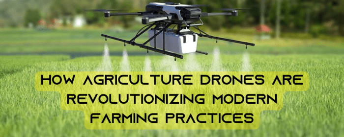
How Autonomous Drones Are Transforming Precision Agriculture? It’s not science fiction, folks. We’re talking about a revolution in farming, where buzzing drones are replacing tractors and spreadsheets, leading to smarter, more efficient, and ultimately, more sustainable agriculture. Forget guesswork; these autonomous marvels are bringing precision to the fields, optimizing everything from crop monitoring to targeted pesticide application. Get ready for a deep dive into the future of food.
This isn’t just about cool tech; it’s about tackling some seriously big challenges. Feeding a growing global population while minimizing environmental impact is a Herculean task, and autonomous drones are proving to be a powerful tool in our arsenal. From reducing water waste to detecting crop diseases early, the impact of this technology is already being felt, and the possibilities are only expanding.
Introduction to Autonomous Drones in Agriculture
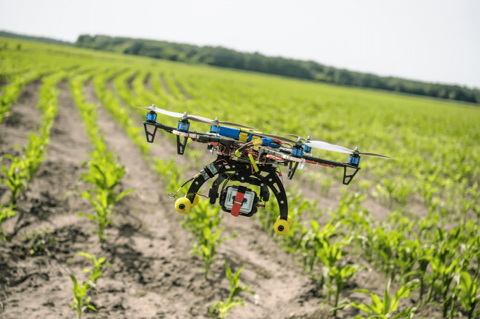
The agricultural landscape is undergoing a significant transformation, driven by the rapid advancement and adoption of autonomous drone technology. No longer a futuristic fantasy, these unmanned aerial vehicles (UAVs) are becoming increasingly integral to modern farming practices, offering a level of precision and efficiency previously unimaginable. This shift towards automation promises to revolutionize how we cultivate our food, impacting everything from crop yield to resource management.
Autonomous drones in agriculture utilize a combination of GPS, advanced sensors, and sophisticated software to navigate fields independently, capturing high-resolution imagery and data. This data is then processed using powerful algorithms to provide farmers with crucial insights into their crops’ health, allowing for targeted interventions and optimized resource allocation. The technology is maturing rapidly, with drones becoming more affordable, reliable, and user-friendly, leading to wider adoption across diverse agricultural settings.
Advantages of Autonomous Drones in Precision Agriculture
The benefits of using autonomous drones over traditional methods are numerous and impactful. Traditional methods, such as manual field inspections and satellite imagery, often lack the detail and immediacy provided by drones. This leads to less precise interventions and potentially lower yields. Drones, on the other hand, offer superior spatial resolution, enabling farmers to identify individual plants exhibiting stress or disease, allowing for precise application of pesticides or fertilizers. This targeted approach minimizes waste, reduces environmental impact, and ultimately boosts profitability.
Economic Impact of Autonomous Drone Adoption
The economic benefits of autonomous drone adoption in precision agriculture are substantial and far-reaching. By optimizing resource use, drones directly contribute to increased crop yields and improved product quality. Reduced input costs, such as fertilizers and pesticides, further enhance profitability. Early detection of crop diseases and pests allows for timely intervention, preventing significant losses. For example, a study by the USDA estimated that drone-based monitoring could reduce pesticide use by up to 40% in certain crops, leading to significant cost savings and environmental benefits. Furthermore, the ability to efficiently monitor large areas reduces labor costs associated with manual inspections. This combination of factors contributes to a stronger overall return on investment for farmers embracing this technology. The increasing affordability of drones and related software also makes this technology accessible to a wider range of farmers, fostering greater economic equity within the agricultural sector.
Applications of Autonomous Drones in Precision Agriculture

Source: zettafarms.com
Autonomous drones are revolutionizing agriculture, moving beyond simple aerial photography to provide farmers with real-time data and precision-guided actions, ultimately boosting yields and resource efficiency. This precision approach minimizes waste, reduces environmental impact, and maximizes profitability. Let’s explore the key applications.
Crop Monitoring with Autonomous Drones
Drones equipped with multispectral or hyperspectral cameras capture detailed imagery of crops. This data is then processed using techniques like Normalized Difference Vegetation Index (NDVI) analysis to assess plant health. NDVI uses the ratio of near-infrared and red light reflectance to determine the vigor and biomass of vegetation. Lower NDVI values indicate stress, possibly due to disease, nutrient deficiency, or water stress. This allows farmers to identify problem areas early on, enabling timely intervention. Furthermore, advanced image processing can detect subtle signs of disease or pest infestations, invisible to the naked eye, enabling preventative measures before widespread damage occurs. For instance, early detection of blight in potato fields allows for targeted treatment, minimizing crop loss.
Precision Spraying with Autonomous Drones
Autonomous drones are transforming pesticide and herbicide application from a blanket approach to a targeted one. Equipped with GPS and sophisticated software, drones can precisely map fields and identify areas requiring treatment. This targeted spraying significantly reduces chemical usage, minimizing environmental impact and lowering costs. For example, drones can identify individual weeds within a crop, applying herbicide only to those weeds, leaving the crop unharmed. This precision spraying also reduces the risk of herbicide resistance development, a growing concern in modern agriculture. The controlled application also minimizes drift, protecting neighboring crops and water bodies from contamination.
Irrigation Management with Autonomous Drones
Efficient irrigation is crucial for optimal crop yields. Autonomous drones, equipped with sensors capable of measuring soil moisture levels, provide real-time data on water needs across the field. This information helps farmers optimize irrigation schedules, ensuring crops receive the precise amount of water they require, minimizing water waste and maximizing water use efficiency. By identifying areas with varying soil moisture levels, drones allow for variable-rate irrigation, applying more water to drier areas and less to already sufficiently moist areas. This targeted approach saves water and reduces energy consumption associated with pumping and distributing water.
Efficiency Comparison: Drone vs. Traditional Methods
| Scenario | Drone Method | Traditional Method | Efficiency Comparison |
|---|---|---|---|
| Crop Health Monitoring | Rapid, high-resolution imagery; NDVI analysis; early disease detection | Manual field scouting; limited coverage; delayed detection | Drones offer significantly faster, more comprehensive, and earlier detection of issues, leading to improved response times and reduced losses. |
| Targeted Pesticide Application | Precise application; reduced chemical usage; minimal drift | Broadcasting or boom spraying; excessive chemical use; potential for drift and environmental damage | Drones significantly reduce pesticide use, minimizing environmental impact and costs while improving efficacy. |
| Irrigation Management | Real-time soil moisture monitoring; variable-rate irrigation; optimized water use | Fixed irrigation schedules; uniform water application; potential for overwatering or underwatering | Drones enable precise water management, saving water, energy, and ultimately increasing yields. |
Technologies Enabling Autonomous Drone Operations
Autonomous drones are revolutionizing precision agriculture, but their capabilities rely on a sophisticated interplay of technologies. From precise navigation to sophisticated data analysis, these systems represent a significant advancement in farming practices. Understanding these core technologies is crucial to appreciating the transformative potential of autonomous drones in agriculture.
The seamless operation of autonomous drones in agriculture depends on a complex yet elegant integration of hardware and software. This synergy allows for precise navigation, accurate data acquisition, and efficient data processing, ultimately leading to improved farm management and optimized yields.
GPS and Navigation Systems
Precise navigation is paramount for autonomous drone operations. GPS (Global Positioning System) provides the fundamental location data, allowing the drone to maintain its planned flight path. However, relying solely on GPS can be insufficient due to signal interference or inaccuracies. Therefore, advanced systems often incorporate RTK (Real-Time Kinematic) GPS, which achieves centimeter-level accuracy by using multiple base stations to correct for GPS errors. This enhanced precision is crucial for tasks like targeted spraying or precise data acquisition over specific areas of a field. Inertial Measurement Units (IMUs) further enhance navigational accuracy by measuring the drone’s orientation and movement, compensating for GPS signal interruptions.
Sensors for Data Acquisition
Autonomous drones employ a variety of sensors to gather crucial agricultural data. The choice of sensor depends on the specific application.
Different types of sensors are employed to collect diverse datasets, enabling a comprehensive understanding of the agricultural environment.
- Multispectral Sensors: These sensors capture images in multiple wavelengths of light beyond the visible spectrum (e.g., near-infrared, red-edge). This data allows for the identification of plant stress, disease, and nutrient deficiencies. For example, healthy vegetation reflects more near-infrared light, which multispectral sensors can detect and translate into indices like NDVI (Normalized Difference Vegetation Index) to assess crop health.
- Hyperspectral Sensors: Offering a far more detailed spectral analysis than multispectral sensors, hyperspectral sensors capture hundreds of narrow spectral bands. This provides incredibly detailed information about plant characteristics, enabling more precise identification of specific stresses or diseases. Hyperspectral imaging can detect subtle variations in plant biochemistry that might go unnoticed with multispectral imaging, leading to more targeted interventions.
- Thermal Sensors: These sensors detect variations in temperature, which can indicate water stress, disease, or other issues affecting plant health. For instance, plants under water stress often exhibit higher temperatures than healthy plants, information easily detected by thermal sensors and used for targeted irrigation.
Image Processing and Machine Learning
The raw data collected by drone sensors is meaningless without sophisticated processing. Image processing techniques are used to clean, enhance, and interpret the images, removing noise and correcting for atmospheric effects.
Machine learning algorithms play a crucial role in transforming raw sensor data into actionable insights.
Machine learning algorithms, particularly deep learning models, are trained on large datasets of labeled images to identify patterns and make predictions. These algorithms can automatically detect plant diseases, assess crop yields, and even identify weeds, enabling precision interventions like targeted herbicide application. For example, a convolutional neural network (CNN) can be trained to identify specific diseases in plants based on their spectral signatures captured by the drone’s sensors. This automated analysis significantly reduces the time and effort required for manual inspections, leading to quicker and more effective responses to potential problems.
Data Flow from Acquisition to Actionable Insights
A clear understanding of the data flow is crucial for efficient drone operations.
The following flowchart illustrates a typical data flow:
(Imagine a flowchart here: Drone Data Acquisition –> Data Transmission (to ground station) –> Image Processing & Preprocessing –> Machine Learning Analysis –> Data Visualization & Reporting –> Actionable Insights (e.g., targeted spraying, irrigation scheduling, fertilizer application). Each step would have a brief description, for instance, under “Machine Learning Analysis” you might see “Disease detection, yield prediction, weed identification using trained algorithms.”)
Autonomous drones are revolutionizing farming, offering precise spraying and crop monitoring. This precision agriculture boom is just one facet of a larger robotic revolution; check out how this broader shift is impacting industries with this insightful article on How Robotics is Changing the Future of Industrial Automation. Ultimately, the efficiency gains seen in agriculture with drones mirror similar advancements across various sectors thanks to robotics.
Challenges and Limitations of Autonomous Drone Technology: How Autonomous Drones Are Transforming Precision Agriculture
The seemingly futuristic world of autonomous drones buzzing across farmlands isn’t without its bumps in the road. While the potential benefits of precision agriculture using drones are immense, several challenges hinder widespread adoption. These obstacles span technological hurdles, regulatory complexities, and economic considerations, each demanding careful consideration before drones become a truly ubiquitous tool in farming.
Regulatory Hurdles and Safety Concerns
The integration of autonomous drones into the agricultural landscape necessitates a robust regulatory framework. Currently, regulations vary widely across countries, creating inconsistencies and potential barriers to innovation. For instance, some regions may have strict limitations on flight altitudes or operational areas, hindering the efficiency of large-scale drone deployments. Furthermore, ensuring the safety of both drone operations and the surrounding environment is paramount. This includes developing effective systems to prevent collisions with other aircraft, birds, or even people, as well as establishing protocols for dealing with malfunctioning drones to minimize potential damage or injury. The absence of standardized safety protocols and clear liability frameworks can also stifle investment and adoption.
Technical Challenges in Autonomous Navigation and Operation
Autonomous navigation in diverse agricultural environments presents significant technical difficulties. Factors such as varying terrain, unpredictable weather conditions (e.g., strong winds, heavy rain), and the presence of obstacles like trees and power lines can all impact drone performance and reliability. Developing robust algorithms that allow drones to navigate these complex environments accurately and safely is a continuous challenge. For example, achieving precise GPS positioning in areas with limited signal reception, such as valleys or heavily forested regions, remains a significant hurdle. Moreover, ensuring the drones can accurately identify and classify different crops and weeds, vital for targeted applications like herbicide spraying, requires sophisticated computer vision and machine learning technologies that are still under development.
Cost-Effectiveness Compared to Other Precision Agriculture Technologies
The economic viability of autonomous drones is another critical factor influencing their adoption. While the potential for increased efficiency and reduced costs in the long run is significant, the initial investment in drones, associated software, and maintenance can be substantial. Comparing the cost-effectiveness of autonomous drones with other precision agriculture technologies, such as satellite imagery or ground-based sensors, is crucial. For smaller farms or those with limited budgets, the upfront investment might outweigh the immediate benefits. Furthermore, the need for skilled operators to manage and maintain the drones adds to the overall cost. A thorough cost-benefit analysis, considering factors like farm size, crop type, and specific application needs, is essential to determine the economic feasibility of adopting autonomous drone technology.
Summary of Challenges, How Autonomous Drones Are Transforming Precision Agriculture
The challenges faced by autonomous drone technology in precision agriculture can be broadly categorized as follows:
- Technological Challenges: Robust autonomous navigation in diverse environments, reliable sensor systems for data acquisition (e.g., high-resolution cameras, multispectral sensors), accurate and efficient data processing algorithms, and integration with existing farm management systems.
- Regulatory Challenges: Lack of standardized regulations across different jurisdictions, safety protocols for preventing collisions and mitigating risks, clear liability frameworks for accidents or data breaches, and airspace management.
- Economic Challenges: High initial investment costs, ongoing maintenance expenses, need for skilled operators, and the need for a clear return on investment compared to other precision agriculture technologies.
Future Trends and Developments
Source: com.br
The agricultural landscape is poised for a dramatic transformation, driven by the relentless advancement of autonomous drone technology. We’re moving beyond simple data collection to a future where drones are integral to every aspect of farming, optimizing resource use and boosting yields in ways previously unimaginable. This section explores the exciting possibilities on the horizon.
The integration of autonomous drones into agriculture is rapidly evolving, fueled by advancements in several key areas. This will lead to a more efficient, sustainable, and profitable farming industry. We can expect to see a significant shift in how farms are managed and how food is produced globally.
Swarm Technology and Enhanced Sensor Capabilities
The future of agricultural drones isn’t just about individual units; it’s about coordinated swarms working in concert. Imagine a fleet of drones, each equipped with specialized sensors, collaboratively surveying a vast field, identifying areas needing irrigation, fertilization, or pest control with unparalleled precision. This coordinated approach drastically reduces surveying time and provides a far more comprehensive dataset than a single drone could achieve. Advancements in sensor technology will further enhance this capability, enabling drones to detect subtle variations in soil composition, plant health, and even the presence of specific pathogens, providing farmers with early warning systems for potential problems. For example, hyperspectral imaging sensors can detect subtle changes in plant chlorophyll levels, indicating nutrient deficiencies before they become visible to the naked eye.
Advancements in Data Analytics and Decision-Support Systems
The sheer volume of data collected by drone swarms necessitates sophisticated analytics. Future systems will utilize artificial intelligence (AI) and machine learning (ML) to process this data in real-time, generating actionable insights for farmers. This will move beyond simple reporting to predictive modeling, allowing farmers to anticipate potential problems and optimize resource allocation proactively. For instance, AI-powered systems could analyze weather patterns, soil conditions, and crop growth data to predict optimal planting times, irrigation schedules, and fertilization needs, maximizing yields while minimizing resource waste. This predictive capability is already being explored by companies like John Deere, which is investing heavily in AI-driven precision agriculture solutions.
Impact on Farming Practices and Food Production
The widespread adoption of autonomous drones will fundamentally reshape farming practices. We can expect a shift towards more data-driven decision-making, precision resource management, and a reduction in the environmental footprint of agriculture. By optimizing fertilizer and pesticide application, drones contribute to sustainable agriculture by reducing chemical runoff and improving water conservation. Increased efficiency in crop monitoring and harvesting translates to higher yields and lower production costs, potentially increasing food security and affordability. Furthermore, drones could play a critical role in addressing challenges like labor shortages and climate change, offering solutions that are both efficient and environmentally conscious. The increased efficiency could also lead to the expansion of organic and sustainable farming practices, making healthier food more accessible.
Hypothetical Scenario: A Fully Integrated Autonomous Farm
Imagine a large-scale farm completely managed by an interconnected network of autonomous drones. Drones equipped with multispectral cameras survey the fields daily, assessing crop health and identifying areas requiring attention. Other drones, carrying specialized payloads, autonomously apply fertilizers and pesticides precisely where needed, minimizing waste. Harvesting drones, working in coordination, efficiently collect ripe crops, reducing labor costs and minimizing losses. Data from all drones is fed into a central AI-powered system that analyzes the information, predicts future needs, and optimizes the entire farm operation, adjusting irrigation, fertilization, and pest control strategies in real-time. This integrated system ensures optimal resource utilization, maximizing yields while minimizing environmental impact. This scenario, while still largely hypothetical, represents the direction the industry is heading towards, driven by ongoing technological advancements and the increasing demand for efficient and sustainable agricultural practices.
Case Studies of Successful Autonomous Drone Implementations
Source: xboom.in
The successful integration of autonomous drones in agriculture isn’t just a futuristic concept; it’s a reality shaping modern farming practices. Several companies and farms are already reaping the benefits of these unmanned aerial vehicles, leading to increased efficiency, reduced costs, and improved crop yields. The following case studies highlight the diverse applications and impactful results achieved through autonomous drone technology in different agricultural settings.
Vineyard Monitoring in Napa Valley, California
One notable example involves a large vineyard in Napa Valley utilizing autonomous drones for precision viticulture. Facing challenges with inconsistent grape ripening across the vast expanse of their vineyards, the vineyard owners implemented a system of autonomous drones equipped with multispectral cameras. These drones autonomously surveyed the entire vineyard, capturing detailed imagery that revealed variations in plant health and grape maturity. The data collected was then processed using sophisticated software to create precise maps highlighting areas requiring specific attention, such as targeted irrigation or fertilization. This allowed for optimized resource allocation, leading to a 15% increase in grape yield and a noticeable improvement in the overall quality of the grapes. The technology employed included GPS-guided autonomous flight, multispectral imaging, and cloud-based data processing and analysis.
Precision Orchard Management in Washington State
An apple orchard in Washington State tackled the challenge of early disease detection and efficient pest control using autonomous drones. Traditional methods proved time-consuming and often inefficient in identifying disease outbreaks or pest infestations in a timely manner. By deploying drones equipped with high-resolution cameras and thermal imaging capabilities, the orchard was able to conduct regular, automated surveys of their vast acreage. The drones’ thermal imaging detected subtle temperature variations indicative of disease or pest stress in individual trees, allowing for targeted intervention. This precise approach significantly reduced the use of pesticides and minimized the risk of widespread crop damage. Key technologies included autonomous flight planning, high-resolution RGB and thermal imaging, and automated data analysis for disease and pest detection.
Large-Scale Farm Management in the Midwest
A large-scale corn and soybean farm in the Midwest utilized autonomous drones to optimize planting, fertilization, and irrigation strategies. The farm faced challenges in ensuring uniform crop growth across its extensive fields due to variations in soil conditions and water availability. Autonomous drones equipped with multispectral sensors and LiDAR technology mapped the entire farm, providing detailed information on soil health, plant density, and water stress levels. This data guided the precision application of fertilizers and irrigation, resulting in a 10% increase in crop yield and a significant reduction in water and fertilizer usage. Technologies included LiDAR for terrain mapping, multispectral imaging for plant health assessment, and variable rate application systems for fertilizer and irrigation.
Case Study Summary Table
| Case Study Name | Location | Technologies Used | Key Results |
|---|---|---|---|
| Napa Valley Vineyard Monitoring | Napa Valley, California | GPS-guided autonomous flight, multispectral imaging, cloud-based data processing | 15% increase in grape yield, improved grape quality |
| Washington State Orchard Management | Washington State | Autonomous flight planning, high-resolution RGB and thermal imaging, automated data analysis | Reduced pesticide use, minimized crop damage |
| Midwest Large-Scale Farm Management | Midwest, USA | LiDAR for terrain mapping, multispectral imaging, variable rate application systems | 10% increase in crop yield, reduced water and fertilizer usage |
Closure
The rise of autonomous drones in agriculture isn’t just a trend; it’s a fundamental shift in how we cultivate our food. By combining cutting-edge technology with age-old farming practices, we’re witnessing a powerful synergy that promises to increase yields, reduce costs, and minimize our environmental footprint. While challenges remain, the future looks bright for a farming landscape where efficiency meets sustainability, all thanks to the tireless buzz of autonomous drones.