
How Autonomous Drones Are Revolutionizing Disaster Relief Operations? It’s a question that’s rapidly moving from the realm of science fiction to everyday reality. Forget slow, cumbersome rescue efforts of the past; autonomous drones are changing the game, offering speed, precision, and reach previously unimaginable in disaster zones. From pinpointing survivors buried under rubble to delivering life-saving supplies to remote villages, these unmanned aerial vehicles are proving invaluable in the race against time.
This isn’t just about faster response times; it’s about saving more lives. Autonomous drones, equipped with advanced sensors and AI, can navigate treacherous terrain, access areas inaccessible to humans, and provide real-time data crucial for effective rescue and recovery. This deep dive explores how these technological marvels are transforming disaster relief, highlighting their applications, challenges, and the exciting future they promise.
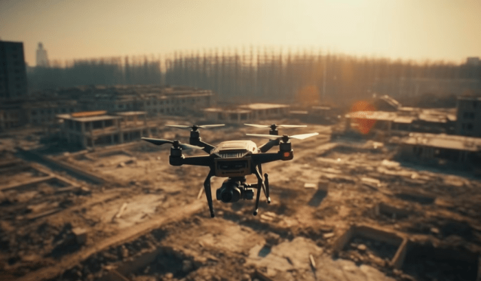
The Rise of Autonomous Drones in Disaster Relief
Source: marvelgeospatial.com
Autonomous drones are game-changers in disaster relief, delivering aid where it’s needed most. This same tech driving efficient emergency response is also shaping the future of transportation, as seen in the advancements explored in The Future of Autonomous Vehicles in Public Transport. The lessons learned in navigating unpredictable disaster zones are directly applicable to building safer, more reliable autonomous public transport systems, ultimately enhancing both emergency and everyday mobility.
For years, disaster relief efforts have relied heavily on human responders, often facing significant challenges in reaching affected areas quickly and efficiently. The aftermath of a hurricane, earthquake, or wildfire often presents a chaotic landscape, hindering traditional methods. Enter autonomous drones, transforming the landscape of disaster response with their speed, agility, and ability to operate in hazardous environments. While initial drone usage in disaster relief was primarily for aerial photography and reconnaissance using manually controlled systems, the shift towards autonomous operations marks a significant leap forward.
The limitations of traditional disaster relief methods are numerous. Ground teams often face impassable roads or dangerous debris fields, slowing down crucial aid delivery. Manned aircraft, while offering a wider view, are expensive to operate, require skilled pilots, and are vulnerable to adverse weather conditions. Furthermore, accessing critical information about the extent of damage and the location of survivors can take valuable time, hindering effective rescue operations.
Autonomous drones, however, offer a compelling solution. Their ability to navigate autonomously, even in challenging terrains and weather conditions, makes them ideal for rapid assessment and delivery of essential supplies. They can access areas inaccessible to ground teams, providing real-time data to aid in search and rescue efforts. Compared to manned aircraft, they are significantly cheaper to operate and require less logistical support. The use of advanced sensors and AI allows for faster and more accurate damage assessments, facilitating more efficient resource allocation.
Comparison of Autonomous Drones and Traditional Disaster Relief Methods
| Capability | Autonomous Drones | Manned Aircraft | Ground Teams |
|---|---|---|---|
| Speed of Deployment | Rapid deployment; can be launched quickly and easily | Requires significant preparation and logistical support; slower deployment | Slowest deployment; significantly hampered by terrain and infrastructure damage |
| Accessibility to Difficult Terrain | Can navigate challenging terrains, including mountainous regions and debris fields | Limited by terrain and weather conditions | Severely limited; often completely blocked by damage |
| Cost-Effectiveness | Significantly lower operational costs compared to manned aircraft | High operational costs due to fuel, maintenance, and pilot salaries | High costs associated with personnel, equipment, and potential risks to human life |
| Data Acquisition and Analysis | Real-time data acquisition using various sensors (thermal, optical, LiDAR); rapid data processing and analysis through AI | Data acquisition is slower; analysis can be time-consuming | Data acquisition is slow and limited; analysis is often delayed |
Applications of Autonomous Drones in Search and Rescue: How Autonomous Drones Are Revolutionizing Disaster Relief Operations
Autonomous drones are rapidly transforming search and rescue (SAR) operations, offering unprecedented capabilities in locating missing persons and assessing disaster zones. Their ability to access difficult terrain, operate in hazardous conditions, and provide real-time data significantly improves response times and increases the chances of successful rescues. This enhanced efficiency is particularly crucial in time-sensitive situations where every minute counts.
The integration of autonomous navigation and advanced sensor technologies allows drones to cover vast areas quickly and effectively, something that would be far more challenging and time-consuming using traditional methods. This translates to a higher probability of finding survivors, especially in large-scale disasters.
Successful Drone Deployments in Search and Rescue
Several successful drone deployments highlight the transformative potential of this technology. For instance, during the 2017 Hurricane Harvey, drones equipped with thermal imaging cameras were used to locate stranded individuals in flooded areas. The ability to see through the darkness and water allowed rescuers to pinpoint victims that would have been otherwise impossible to find quickly. Similarly, following earthquakes, drones have been instrumental in mapping debris fields and identifying potential survivors trapped beneath rubble. The speed and efficiency of drone surveys allowed rescue teams to prioritize their efforts and allocate resources effectively.
Autonomous Navigation and Obstacle Avoidance in Challenging Environments, How Autonomous Drones Are Revolutionizing Disaster Relief Operations
Autonomous navigation is paramount in SAR operations, particularly in complex and hazardous environments. Advanced algorithms allow drones to navigate autonomously, avoiding obstacles such as trees, buildings, and power lines, even in low-visibility conditions. This capability is crucial in areas affected by natural disasters, where infrastructure might be damaged and the terrain altered. Sophisticated obstacle avoidance systems, employing technologies like LiDAR and computer vision, ensure the safety of the drone and maximize its operational effectiveness. This minimizes the risk of drone loss and ensures the continued provision of critical information to rescue teams.
The Use of Thermal Imaging and Other Sensors for Locating Survivors
Thermal imaging cameras are a game-changer in SAR operations. These sensors detect the heat signatures of living beings, even in dense vegetation or through smoke and debris. This allows rescuers to locate survivors who might be hidden or unconscious. Beyond thermal imaging, other sensors, such as multispectral and hyperspectral cameras, can provide additional information about the environment and potential hazards. This comprehensive data gathering capability empowers rescue teams with a clearer understanding of the situation, leading to better decision-making and more efficient rescue efforts.
Scenario: Drone-Assisted Search for a Missing Person in a Flooded Area
Imagine a scenario where a person goes missing during a severe flood. The area is inundated with water, making ground-based searches extremely dangerous and difficult. An autonomous drone equipped with a thermal imaging camera and GPS is deployed. The drone autonomously navigates the flooded area, utilizing its obstacle avoidance system to maneuver around debris and submerged objects. The thermal camera detects a heat signature consistent with a human being trapped on the roof of a partially submerged building. The drone’s GPS coordinates are transmitted to the rescue team, who can then swiftly deploy a boat to rescue the individual. This rapid response, facilitated by the drone, significantly increases the chances of survival.
Autonomous Drones for Damage Assessment and Mapping
The aftermath of a natural disaster often leaves emergency responders scrambling to understand the extent of the damage. Traditional methods of assessment, relying on ground surveys and manual data collection, are slow, dangerous, and often inaccurate, especially in large-scale disasters. Autonomous drones, however, are revolutionizing this process, providing rapid, high-resolution data crucial for efficient and effective disaster relief.
Drones equipped with advanced sensors can create detailed, three-dimensional maps of disaster-affected areas far more quickly and comprehensively than ever before. This ability to quickly survey large areas provides vital information to aid in rescue efforts, resource allocation, and long-term recovery planning.
High-Resolution Mapping of Disaster-Affected Areas
Autonomous drones utilize a variety of sensors, including high-resolution cameras, LiDAR (Light Detection and Ranging), and multispectral or hyperspectral cameras, to capture incredibly detailed imagery of affected regions. LiDAR, for instance, uses laser pulses to create precise 3D models, revealing the topography of the landscape even under challenging conditions like dense smoke or debris. High-resolution cameras capture detailed images of buildings, infrastructure, and the overall landscape, while multispectral and hyperspectral cameras can detect subtle variations in the reflected light, helping to identify damaged areas, assess the severity of flooding, or even detect the presence of hazardous materials. This data is then processed using specialized software to create accurate and detailed maps, providing a comprehensive overview of the disaster’s impact. For example, following Hurricane Maria in Puerto Rico, drones equipped with high-resolution cameras were instrumental in mapping the extent of the damage to infrastructure, enabling more efficient allocation of resources for repairs.
Assessing Structural Damage Using Drone Imagery
The imagery captured by drones is analyzed using sophisticated computer vision algorithms and photogrammetry techniques. These algorithms can automatically detect and classify damaged structures, identifying things like collapsed roofs, broken windows, and cracks in walls. By comparing pre-disaster imagery (if available) with post-disaster images, the extent of the damage can be precisely quantified. The analysis can provide information on the stability of buildings, helping to prioritize rescue and evacuation efforts. For instance, in the aftermath of an earthquake, drones could rapidly assess the structural integrity of buildings, identifying those at risk of collapse and guiding rescue teams to prioritize safer areas. This precise assessment allows for targeted interventions, optimizing resource allocation and ensuring the safety of rescue workers.
Speed and Accuracy Compared to Traditional Methods
Drone-based damage assessment is significantly faster and more accurate than traditional methods. Traditional ground surveys are time-consuming, require large teams of personnel, and can be dangerous in hazardous environments. Moreover, human error can lead to inaccuracies in assessment. Drones, on the other hand, can cover vast areas in a fraction of the time, providing a more comprehensive and objective assessment. The automated analysis of drone imagery further reduces the possibility of human error, leading to greater accuracy. For example, after a wildfire, drones can quickly map the burned area, providing accurate data on the extent of the damage far more quickly than ground crews, allowing for more rapid deployment of firefighting resources and post-fire recovery efforts.
Informative Disaster Relief Strategies Using Drone Data
The high-resolution maps and damage assessments provided by drones are invaluable for informing disaster relief strategies. This data helps emergency responders prioritize rescue efforts, allocate resources efficiently, and plan for long-term recovery. For example, following a flood, drone data can be used to identify areas with the most severe flooding, guiding rescue teams to those in need. Similarly, post-hurricane, drone imagery can pinpoint areas with the greatest need for shelter and supplies, enabling efficient distribution of aid. In the long-term, drone data can be used to inform rebuilding efforts, helping to identify areas needing infrastructure repairs and guiding the design of more resilient communities. The comprehensive nature of the data allows for better planning and more effective utilization of resources, leading to improved outcomes in disaster relief operations.
Delivery of Essential Supplies via Autonomous Drones
The rapid deployment of essential supplies in the aftermath of a disaster is crucial for saving lives and mitigating suffering. Autonomous drones, with their ability to navigate challenging terrains and reach remote areas inaccessible by traditional methods, are revolutionizing this critical aspect of disaster relief. Their speed and precision offer a significant advantage over ground-based transport, particularly when time is of the essence.
Autonomous drones are transforming how we deliver vital aid, offering a lifeline to those most in need. Their ability to bypass damaged infrastructure and reach isolated communities makes them an invaluable asset in disaster response. However, integrating this technology effectively requires careful consideration of various operational and design factors.
Challenges in Autonomous Drone Delivery in Disaster Zones
The deployment of autonomous drones for supply delivery in disaster zones faces numerous challenges. Unpredictable weather conditions, such as strong winds, heavy rain, and even snow, can severely impact drone flight stability and operational range. Furthermore, damaged or nonexistent infrastructure, including power grids and communication networks, can hinder the drones’ navigation and communication capabilities. Obstacles like downed power lines, debris fields, and damaged buildings present significant flight hazards. Finally, security concerns, including the potential for drones to be misused or intercepted, necessitate robust security protocols and operational strategies.
Design Considerations for Supply-Carrying Drones
To effectively deliver essential supplies, drones require specific design considerations. Payload capacity is paramount, necessitating a robust airframe capable of carrying sufficient quantities of medicine, food, and water. The design must also incorporate a reliable and accurate drop mechanism to ensure supplies reach their intended destinations without damage. Furthermore, drones need to be equipped with advanced navigation systems capable of operating in GPS-denied environments, relying on alternative sensor technologies such as LiDAR or visual odometry. Battery life is another crucial factor, demanding efficient power management systems to extend operational range and endurance. Finally, weatherproofing and durability are essential for operation in challenging environmental conditions. For example, a drone designed for flood relief would need buoyancy features and materials resistant to water damage.
Step-by-Step Procedure for Autonomous Drone Supply Delivery
Effective delivery of supplies using autonomous drones requires a structured and well-defined procedure.
- Pre-flight planning and mission programming: This involves defining the flight path, identifying drop zones, and programming the drone’s navigation system with waypoints and relevant data, accounting for potential obstacles and weather conditions.
- Loading and securing supplies: Carefully loading the designated supplies into the drone’s payload compartment, ensuring they are securely fastened to prevent shifting during flight.
- Pre-flight checks and system diagnostics: Thoroughly inspecting the drone for any mechanical issues, checking battery levels, and verifying the functionality of all onboard systems before commencing the mission.
- Launch and autonomous flight: Launching the drone and monitoring its flight path and status via a remote control system, ensuring it follows the pre-programmed route and avoids any unexpected obstacles.
- Supply drop and confirmation: Executing the automated drop mechanism at the designated drop zone and verifying successful delivery using onboard cameras or sensors. This might involve using a parachute system for heavier loads or a more precise drop mechanism for delicate items.
- Return to base and post-flight analysis: The drone returns to its designated landing zone, and a post-flight analysis is conducted to review flight data, identify areas for improvement, and ensure the drone is ready for subsequent missions.
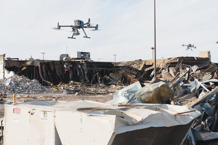
Communication and Coordination with Autonomous Drones
Source: aonic.com
In the chaotic aftermath of a natural disaster, effective communication is paramount for efficient rescue and relief operations. Damaged infrastructure often renders traditional communication systems unusable, creating a critical information gap. Autonomous drones, however, offer a unique solution by providing a flexible and rapidly deployable communication platform, bridging this gap and facilitating coordinated responses. Their ability to fly over damaged areas and establish temporary communication networks is proving revolutionary in disaster relief.
Drones equipped with various communication modules can significantly enhance communication in disaster zones. These modules can relay information from ground teams to emergency response centers, facilitating real-time updates on the situation, location of survivors, and resource needs. Furthermore, drones can establish temporary communication networks, enabling communication between isolated teams and communities cut off from traditional infrastructure. This enhanced communication directly translates to faster and more effective rescue efforts, saving lives and minimizing further damage.
Drone-Based Communication Networks for Coordinated Rescue Efforts
Drone-based communication networks play a vital role in coordinating rescue efforts by providing a real-time situational awareness platform. By acting as mobile communication relays, drones can connect disparate teams on the ground, allowing them to share critical information, coordinate their actions, and avoid duplication of effort. This coordinated approach is particularly crucial in large-scale disasters where multiple agencies and teams are involved. For example, in the aftermath of a hurricane, drones could connect search and rescue teams with medical personnel, enabling efficient triage and evacuation of injured individuals. The real-time data transmitted by drones allows for dynamic adjustments to rescue plans, optimizing resource allocation and maximizing the effectiveness of the overall response.
Comparison of Communication Protocols for Autonomous Drones
Several communication protocols are used with autonomous drones, each with its own advantages and disadvantages. These include:
- Line-of-Sight (LOS) communication: This method uses radio waves for direct communication between the drone and a ground station. It’s simple and reliable within range, but limited by the drone’s visual range and obstacles. Suitable for short-range, localized communication.
- Beyond-Line-of-Sight (BLOS) communication: This method utilizes cellular networks, satellite links, or other relay systems to extend the communication range beyond the drone’s visual line. It’s more complex and potentially less reliable due to network limitations and potential interference, but allows for broader coverage. Useful for wider area communication and coordination.
- Mesh Networking: This involves creating a network of interconnected drones, where each drone acts as a relay for communication between others and the ground station. This approach is highly robust and can adapt to changing conditions, providing redundant communication paths. However, it requires more complex software and coordination among the drones.
The choice of communication protocol depends on factors such as the scale of the disaster, the terrain, the availability of infrastructure, and the specific communication needs. A hybrid approach, combining multiple protocols, might be optimal for many scenarios.
System Architecture for a Drone-Based Communication Network in a Disaster Scenario
A robust drone-based communication network in a disaster scenario requires a well-defined architecture. A central ground control station would manage and coordinate the network, receiving data from various drones and transmitting instructions. The drones themselves would act as mobile communication nodes, equipped with multiple communication modules (e.g., LOS radio, cellular modem, satellite uplink) for redundancy and flexibility. A data fusion system at the ground station would integrate data from multiple sources, including drones, ground teams, and existing communication infrastructure, to provide a comprehensive overview of the situation. Security measures, such as encryption and authentication, are crucial to protect the integrity and confidentiality of the transmitted data. This system could be further enhanced by integrating AI-powered algorithms for automatic routing, network optimization, and anomaly detection. This architecture would ensure resilience, scalability, and efficient management of the communication network during a disaster.
Ethical and Legal Considerations of Autonomous Drones in Disaster Relief
The increasing use of autonomous drones in disaster relief presents a complex interplay of benefits and challenges. While offering unprecedented speed and efficiency in response efforts, their deployment raises significant ethical and legal questions that demand careful consideration and proactive solutions to ensure responsible and equitable use. Balancing the urgent need for effective disaster response with the potential for misuse and unintended consequences is crucial for building public trust and maximizing the positive impact of this technology.
Potential Ethical Concerns in Autonomous Drone Deployment
The autonomy of these drones introduces ethical dilemmas not present with human-piloted aircraft. Concerns arise regarding algorithmic bias, potentially leading to unequal distribution of aid or disproportionate impact on certain vulnerable populations. Questions of accountability in case of accidents or malfunctions, where the responsibility lies between the developers, operators, and regulatory bodies, remain unresolved. Furthermore, the potential for misuse, such as unauthorized surveillance or weaponization, necessitates stringent safeguards. The lack of human oversight in critical decision-making processes also raises concerns about transparency and the potential for errors with potentially devastating consequences.
The Legal Framework Governing Autonomous Drone Operations
The legal landscape surrounding autonomous drones varies significantly across countries. Many nations are still developing specific regulations for their operation, particularly in the context of disaster relief. Existing regulations often focus on airspace management, licensing requirements, and data privacy, but may not adequately address the unique challenges posed by autonomous systems. International collaboration is crucial to establish consistent standards and ensure legal harmonization, preventing jurisdictional conflicts and promoting safe and responsible drone deployment in cross-border disaster response efforts. For instance, the FAA in the United States has specific regulations regarding drone operation, including weight limits and certifications, but these regulations are constantly evolving to adapt to the technological advancements in the field. Similarly, the European Union is working towards a unified regulatory framework for drones, aiming to balance innovation with safety and security.
Data Privacy and Security in Drone-Based Disaster Relief
Autonomous drones collect vast amounts of data during disaster response, including images, videos, and sensor readings that may contain sensitive personal information. Protecting the privacy and security of this data is paramount. Robust data encryption, anonymization techniques, and secure data storage protocols are essential to prevent unauthorized access and misuse. Clear data governance policies, including data retention periods and procedures for data sharing, are needed to maintain public trust and comply with data protection regulations like GDPR in Europe and CCPA in California. Transparency regarding data collection and usage practices is also crucial to build public confidence and ensure accountability.
Recommendations for Ethical Guidelines and Regulations
Establishing a robust ethical and legal framework for autonomous drones in disaster relief requires a multi-stakeholder approach involving government agencies, drone manufacturers, humanitarian organizations, and ethicists. This framework should prioritize human safety, data privacy, accountability, and equitable access to aid. Clear guidelines are needed on algorithmic transparency and bias mitigation, ensuring fairness and preventing discrimination in aid distribution. Standardized protocols for accident investigation and liability determination are also crucial. Furthermore, mechanisms for public oversight and feedback should be established to promote transparency and responsiveness to evolving ethical concerns. Regular audits and independent evaluations of drone operations are necessary to ensure adherence to ethical guidelines and legal requirements. International cooperation is essential to harmonize regulations and promote best practices globally, maximizing the benefits of this technology while mitigating potential risks.
Future Trends and Technological Advancements
The future of disaster relief hinges on the continued evolution of autonomous drones. We’re not just talking about incremental improvements; we’re looking at a paradigm shift in how we prepare for and respond to catastrophes. The advancements in AI, materials science, and sensor technology are poised to dramatically increase the effectiveness and reach of these unmanned aerial vehicles.
The integration of increasingly sophisticated technologies promises to transform autonomous drones from helpful tools into indispensable partners in disaster response. This section explores the key areas driving this transformation, painting a picture of what’s on the horizon for this rapidly evolving field.
Artificial Intelligence and Machine Learning Enhancements
AI and machine learning are set to revolutionize autonomous drone capabilities. Current drones rely heavily on pre-programmed flight paths and limited decision-making. However, future iterations will leverage AI to enable more adaptive and intelligent flight, including autonomous obstacle avoidance in complex and unpredictable environments like collapsed buildings or debris fields. Machine learning algorithms can analyze vast amounts of data from various sensors to identify survivors, assess damage, and optimize search patterns, significantly improving efficiency and effectiveness. For instance, AI could analyze thermal imagery to pinpoint individuals trapped under rubble with greater accuracy than human operators currently achieve. Furthermore, AI-powered drones could learn from past disaster responses, adapting their strategies and improving their performance over time.
Advanced Drone Designs for Enhanced Resilience and Adaptability
The drones of tomorrow will be built to withstand the harshest conditions. Current limitations in battery life, range, and durability are being addressed through advancements in materials science and drone design. We can expect drones with longer flight times, greater payload capacities, and improved resistance to extreme weather conditions like high winds, heavy rain, and even wildfire smoke. For example, drones with foldable or modular designs could be easily transported and deployed in remote or inaccessible areas. The development of more robust and adaptable drone designs will expand their operational capabilities and allow for continuous operation during extended disaster relief efforts.
Integration with Satellite Imagery and IoT Sensors
The true potential of autonomous drones will be unlocked through seamless integration with other technologies. Combining drone-based data with satellite imagery provides a comprehensive overview of the disaster area, allowing for better situational awareness and more effective resource allocation. The integration of Internet of Things (IoT) sensors, such as environmental monitors and communication relays, can further enhance data collection and improve coordination between rescue teams and support personnel. Imagine a scenario where drones autonomously deploy IoT sensors in affected areas, creating a real-time network that provides crucial information on environmental conditions, structural integrity, and the location of survivors. This integrated approach will provide a far more holistic and accurate picture of the situation on the ground.
Enhancing Disaster Preparedness and Response
The future role of autonomous drones extends beyond immediate response; they will become integral to disaster preparedness. Drones can be used to create detailed 3D maps of vulnerable areas, identifying potential risks and informing evacuation plans. Regular autonomous drone patrols could monitor critical infrastructure, detecting potential hazards before they escalate into major disasters. Furthermore, pre-programmed flight paths and emergency response protocols can be established for rapid deployment in the event of a disaster. This proactive approach, combined with the advancements in drone technology, will lead to faster response times, more effective rescue operations, and a significant reduction in loss of life and property damage.
Last Point
The integration of autonomous drones into disaster relief operations marks a pivotal shift towards more efficient, effective, and ultimately, life-saving responses. While challenges remain—from regulatory hurdles to technological limitations—the potential benefits are undeniable. As technology continues to evolve, expect autonomous drones to play an increasingly crucial role, not only in responding to disasters but also in bolstering preparedness and mitigating future risks. The future of disaster relief is taking flight, one autonomous drone at a time.